StalagMight
Underwater Cave Survey & Mapping
Free, open-source underwater cave survey software. Simple data entry, fast visualization, and easy map exports.
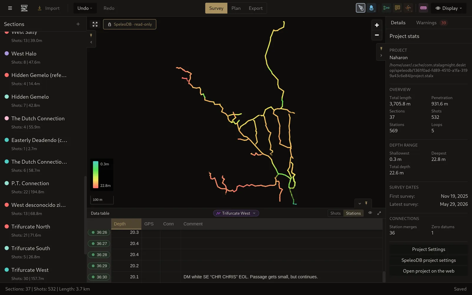
Free, open-source underwater cave survey software. Simple data entry, fast visualization, and easy map exports.
Everything you need to go from raw survey data to a finished map.
No trials, no subscriptions, no paywalls — Stalagmight is free to use and always will be. All source code is public, so you can inspect it, modify it, or contribute back.

Import DMP files directly from mNemo survey device, or enter data by hand with a built-in spreadsheet.

Connect surveyed sections together visually, enter comments, add loop closures and edit survey data with very little need for tabular data entry. StalagMight encourages intuitive survey building and assists with section placement.

Collaborate with other StalagMight users on SpeleoDB and enjoy its versioning and backup features.

Use the survey data to plan future dives, estimate stage drop points and penetration range.

Read existing survey files instead of retyping them — Ariane, Compass, Walls and GPX. Export finished maps as SVG, PNG or PDF, and the survey data itself as CSV, JSON or Ariane TML.
Download StalagMight for free. Available on Windows, macOS, and Linux.
Get the source on GitHub